How to Choose Air Pollution Detection Drones in 2026
Choosing Air Pollution Detection Drones in 2026 is not simply a matter of selecting a flight platform. The sensor, sampling method, and mission design determine whether readings are useful. The World Health Organization reported that 99% of the global population lived in places where air quality exceeded its guideline limits in 2019. The Health Effects Institute’s State of Global Air 2024 estimated that air pollution contributed to 8.1 million deaths worldwide in 2021. The stakes are real. Yet a drone is not a complete air-quality monitoring system.
For buyers, the practical question is whether a drone can collect reliable, location-specific measurements safely and repeatably. Compare payload weight, flight time, sensor detection limits, calibration requirements, and data handling. A compact optical particle sensor may map changing PM2.5 levels, while gaseous pollutants can require different instruments. Wind, rotor wash, humidity, and sensor placement can affect results. Small details matter. Ask vendors for calibration records, field-validation results, and clear explanations of measurement uncertainty. Compare drone readings with suitable reference instruments where possible; a striking map is not proof of accuracy. Regulatory requirements and flight permissions also vary by location, so verify local rules before planning operations. One caveat deserves attention: specifications rarely show how a system performs after months of field use. That gap should prompt careful questions, not blind confidence. This guide outlines how to assess platforms, sensors, and support in 2026, while recognizing that the best setup depends on the pollutant, site, and purpose. A careful choice can improve coverage. It cannot remove every uncertainty.
Define Monitoring Goals with WHO’s 5 µg/m³ Annual PM2.5 Guideline
Choosing an air pollution detection drone starts with a clear monitoring goal. The World Health Organization’s guideline for annual mean PM2.5 is 5 µg/m³. It is a long-term benchmark, not a limit that one brief flight can confirm or rule out. Plan for repeated measurements across seasons and locations.
A drone can map how fine particles vary near roads, rooftops, or industrial areas. But sensor readings need context. Temperature and humidity can affect low-cost particle sensors, and rotor airflow may disturb sampling. Look for a payload that records PM2.5 alongside time, location, and humidity. Check whether its data can be compared with a ground reference monitor. Small differences matter. A reading of 6 µg/m³ on one flight does not establish an annual average above the guideline.
Before selecting a platform, decide how often it must fly, how much sensor weight it can carry, and whether its routes can be repeated safely. Keep a written calibration and maintenance log. Dust on an inlet can quietly change results. The map may look precise, but uncertainty remains; I would report it rather than smooth it away. A drone is most useful as part of a wider monitoring plan, not a substitute for long-term measurements.
Select Sensors for PM2.5, NO₂, O₃, CO, and VOCs
How to Choose Air Pollution Detection Drones in 2026
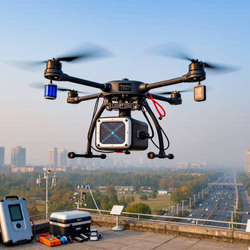
A useful drone payload starts with the pollutants you need to measure, not the number of sensors it can carry. For PM2.5, optical particle sensors estimate fine-particle levels from scattered light. Dust, humidity, and rotor wash can distort readings. Keep the inlet clear of propellers and record weather conditions during each flight.
For NO₂ and O₃, check the sensor’s measurement range, response time, and cross-sensitivity to other gases. Electrochemical cells can be compact, but temperature changes may affect their output. CO sensors often use the same technology and need regular calibration checks. Small differences matter. A zero check before launch can reveal drift, though it cannot replace comparison with a trusted reference instrument.
VOCs need special care. A photoionization detector can indicate the presence of many volatile compounds, but it usually cannot identify each one. That distinction matters when interpreting a map. Match the sensor to the question, then test it at ground level before flying. Rotor airflow, vibration, and rapid altitude changes can complicate sampling. Log the drone’s position, height, and time alongside every reading. A neat chart may still hide messy data; review outliers before treating them as evidence.
Match Payload and Flight Time to the FAA’s 120 m (400 ft) Limit
How to Choose Air Pollution Detection Drones in 2026
Match Payload and Flight Time to the FAA’s 120 m (400 ft) Limit
The FAA’s 14 CFR §107.51(b) generally limits small-drone flight to 400 feet above ground level, with a defined exception near structures. That ceiling shapes sampling plans: a sensor may need to collect useful readings during short, repeatable passes rather than climb higher. Check the operating rules and airspace conditions for each site.
Start with the complete payload: sensor, inlet, mount, cables, and any protective housing. Their combined mass affects endurance, while a poorly placed inlet can sample rotor wash instead of ambient air. EPA’s 2022 Enhanced Air Sensor Guidebook stresses checking sensor performance against reference monitors. A longer flight is not automatically a better measurement.
Ask for flight-time figures with the intended payload installed, then test them in representative wind and temperature. Plan a reserve rather than treating the advertised maximum as usable survey time; a 20 percent allowance is a practical starting point, not a guarantee. That matters. Compare usable minutes at the planned altitude with the time needed for takeoff, sampling, and landing. A payload spreadsheet can still mislead: real endurance changes with batteries, weather, and maneuvering. Record those conditions alongside each sample, so later comparisons have context.
Check Sensor Readings Against EPA’s 9 ppm 8-Hour CO Standard
How to Choose Air Pollution Detection Drones in 2026
EPA’s 9 ppm eight-hour carbon monoxide standard is a useful reference when choosing a detection drone. It is not a pass-or-fail limit for one flight. The standard concerns an eight-hour average, with regulatory monitoring rules that a short drone survey may not reproduce. Keep that distinction clear. A single spike does not establish a violation, and a brief low reading does not prove clean air.
Check whether the sensor measures CO at low concentrations and records time-stamped data. Ask how often it needs calibration, how quickly it responds, and whether temperature or humidity can affect results. During a flight, propeller airflow may also disturb sampling. Sensor placement matters. Compare readings averaged over suitable periods, not isolated peaks, and document flight height, route, weather, and calibration status. These details make comparisons more useful, though they do not turn drone data into official compliance measurements.
One flight log may look messy. That can happen near traffic, vents, or shifting wind. Treat unusual readings as prompts for a repeat measurement with a suitable reference instrument. Choose a system that preserves raw data and explains uncertainty; a neat dashboard is not enough.


